
Whernside Hike Guide – Yorkshire's Highest Peak (736m)
- Kate

- May 1, 2025
- 4 min read
Updated: Sep 10, 2025

Key Information for Hiking Whernside
Distance: Approx. 8 miles (13 km) circular
Time Required: 4–5 hours
Elevation Gain: ~500 metres
Difficulty: Moderate
Facilities: Limited (Station Inn only); no public toilets
Best For: Scenic views, historical landmarks, and varied terrain
Weather Note: Conditions on the summit can be harsh, especially in winter. Be sure to bring warm layers, waterproofs, and suitable footwear.
Starting point: Ribblehead Viaduct, Postcode: LA6 3AU - Click to go straight into Google Maps

If you're seeking a scenic and moderately challenging hike through the heart of the Yorkshire Dales, Whernside offers an exceptional experience. At 736 metres, it is the tallest of the Yorkshire Three Peaks. It offers a blend of rugged beauty, panoramic views, and historical landmarks, making it a memorable route for both casual and experienced hikers.
This post may contain affiliate links. I only ever recommend products that I have personally tried, tested, and genuinely believe in. If you purchase through one of my links, I may earn a small commission at no extra cost to you. This helps support my blog and allows me to keep sharing honest reviews and hiking content. Thank you for your support!

Getting There and Facilities
The hike begins at Ribblehead Viaduct, a striking 19th-century railway structure featuring 24 massive stone arches that reach 32 metres in height. The viaduct is a landmark of industrial heritage and a dramatic starting point for the trail. Reportedly, the Midland Railway had to extend the nearby graveyard due to the high number of deaths during its construction.
Parking is generally available off-road near the viaduct (postcode: LA6 3AU) and is usually sufficient, even during busier seasons. The nearby Station Inn pub is popular among walkers; it serves food and allows overnight camping for those who purchase a meal. Please note that there are no public restrooms available at the trailhead.
More Hiking Blog Posts:
Hiking Whernside - Overview and Directions
Starting the Walk: From the parking area, head toward the viaduct and follow the wide gravel track that runs parallel to the railway line. You'll pass close to the impressive arches of the viaduct and then walk alongside the line for some time.

Use code SHESGOINGSOLO15 for 15% off. Passing the Old Station House: You'll come across a charming abandoned station house not long into the walk. It's a picturesque reminder of the area's rail heritage and offers a good photo opportunity.
Force Gill Detour (Optional): Continue along the path until you see a small sign or visible trail leading to Force Gill, a lovely, secluded waterfall. While not part of the main route, it's a short and worthwhile detour down a narrow path for those who wish to explore the water feature.
Beginning the Ascent: Back on the main route, the path starts to climb steadily as it joins the Dales Highway. This section is generally well-defined and maintained. About halfway up the slope, there's an optional detour to visit Whernside Tarns, a peaceful spot ideal for a short rest or snack.

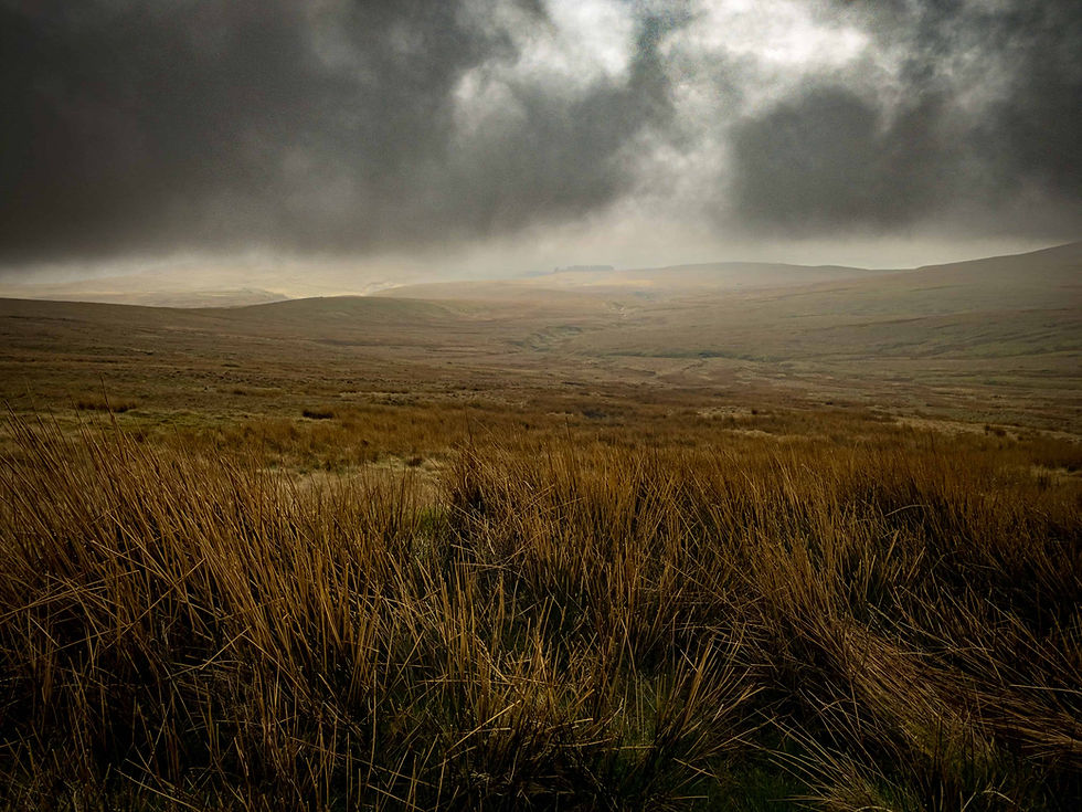
The top of Whernside Final Climb and Summit Ridge: The trail becomes steeper after the tarns. As you continue climbing, the views open up dramatically. Upon reaching the summit ridge, you'll turn south and follow a clear path toward the top of Whernside. A dry stone wall runs alongside this section, offering some protection from the wind. To the east, you'll see the rolling Howgill Fells, and on a clear day, views stretch as far as the Lake District. A cairn marks the summit, and there is also a gap in the wall where you can view the western landscape. This is a popular lunch spot, weather permitting.

Use code SELK-GOINGSOLO15 for 15% off. Descent via the Pennine Journey Trail: After the summit, continue heading south along the ridge, now following the Pennine Journey Trail. You'll soon reach a well-built stepped path that begins the descent. This section is quite steep and treacherous in icy or wet conditions, so caution is advised.
Approaching the Farm: Once you reach the valley floor, the trail guides you toward a working farm. Follow the designated footpaths through the fields.
Hiking Routes
Returning to the Viaduct: After passing the farm, follow the route northeast, which gradually loops back to the Ribblehead Viaduct. You'll complete your circuit at the original parking area.


Hire all your Wild Camping and Water Sports gear here. Subscribe to my monthly newsletter for more hiking routes, gear reviews, and adventure tips—delivered straight to your inbox! Click here.
Are you new to wild camping? Check out The Beginner's Guide to Wild Camping for everything you need to get started.
Do you have any questions or thoughts? Feel free to contact me here—I'd love to hear from you.
If you haven't already, consider downloading the Ordnance Survey App. It lets you import GPX routes directly and mirrors the paper maps you should always carry as a backup. I use this app to plan all my hikes, and it's an essential tool for navigating the great outdoors.

https://soicau247.com/ bữa lướt thấy mọi người share nên mình vào xem thử cho biết thôi. Mình không rành vụ soi cầu hay chốt số gì, chủ yếu xem trang trình bày có dễ nhìn không. Cảm giác họ chia nội dung thành từng mảng khá rõ, kéo xuống là thấy ngay phần kết quả và mấy khối dự đoán theo ngày nên không bị lạc. Mình thích nhất là cái tiêu đề kiểu “Xổ số Miền Bắc ngày 03/06/2026” để nổi bật, nhìn phát biết đang xem đúng ngày nào. Với lại bảng lô tô đầu/đuôi họ làm dạng cột gọn gàng, nhìn nhanh vẫn bắt được số mà không rối mắt, nhất là phần đầu/đuôi lô tô hiển thị…
kèo nhà cái 55 mình thấy trên mấy group nhắc hoài nên ghé vào coi thử cho biết. Vừa mở lên là thấy họ xếp các bài soi kèo theo kiểu danh sách, nhìn phát là biết bài nào đang mới, lướt cũng nhanh. Mình bấm thử một trận bất kỳ thì bài viết chia đoạn gọn gàng, đọc vài dòng đầu là nắm được tình hình chứ không bị chữ dồn kín màn hình. Kéo xuống cũng mượt, không phải vừa đọc vừa tìm chỗ đang ở. Mình thích nhất là tiêu đề trận với giờ đá được làm nổi ngay trong khung bài, nhìn cái là nhận ra liền. Nói chung giao diện đơn giản mà dễ theo…