
A Thru-Hike of The Cumbria Way: Exploring The Lake District on Foot
- Kate
- Nov 1, 2022
- 9 min read
Updated: Aug 19, 2025
Day 1 - Ulverston to Coniston - 15.5 miles/25km
Day 2 - Coniston to Langdale - 11.5 miles/19km
Day 3 - Langdale to Keswick - 15.5 miles/25km
Day 4 Keswick to Caldbeck - 15 miles/24km
Day 5 - Caldbeck to Carlisle - 15.5miles/25km
(Please note: I only walked to Dalston, cutting off 5 miles at the end to miss out on back streets into Carlisle)

What better way to explore the beautiful Lake District than on foot? Here's how you can thru-hike The Cumbria Way in 5 days and access more of the idyllic landscape this area offers while staying in youth hostels and bunk barns along the way.
She's Going Solo may receive commissions for links included in articles to Amazon and other affiliate partners. Recommendations are not given out lightly, and all products recommended have been tried and tested.
Day 1 of The Cumbria Way- To Coniston Water

After an early start and a bleary-eyed taxi ride to the railway station and three trains later, I was in Ulverston, hoping to find the beginning of The Cumbria Way. After all this travelling, putting one foot in front of the other felt incredible as I made my way northwards! The Cumbria Way starts in the small town centre of Ulverston; there is an obelisk to mark the start of the trail. If you look closely, there is also a gorgeous little blue sign on a bench, which means you can quickly sort out your stuff before you embark on your journey.

As I left the small town, I felt completely free. Not a care in the world. It was just me and the beautiful landscape ahead of me, and it felt amazing. The trail followed Gill Banks Beck and headed into green flowing farmland; at this point, the track felt relatively flat and not too strenuous. Once you hit The National Park border, it becomes more demanding on the thighs, particularly when you have overpacked your backpack as I did. However, you soon see the outline of the rugged mountain tops, which gives you the boost you need to keep going. You soon reach Beacon Tarn, a gorgeous, quiet little tarn that you could wild camp at if you wanted to; however, I was heading to the town of Coniston.
Upon reaching the shores of Coniston Water, the views didn't fail to take my breath away. The sun was setting, and the water looked stunning, with the red glow reflecting off the water and The Old Man of Coniston greeting me from above! The walk along the water was challenging, I can't lie; after an early start and a heavy backpack, I was feeling it. However, some positive words from home spurred me on. Eventually, I made it to Holly How Youth Hostel and had a well-deserved meal in a local pub and possibly a large glass of red wine.

Day 2 The Cumbria Way - Towards The Langdales
The next day, I woke up refreshed and ready to continue my journey. The Langdales were in my sights, and I was excited to be heading that way. It was all uphill for the first part of the day, but the views kept me going with determination. I arrived at Skelwith Bridge for lunchtime and felt it would be rude not to stop and try a pub meal. The Skelwith Bridge hotel looked inviting sitting along the riverside. So, I stopped for a steak baguette and a pint of lime and soda; unbeknown to anyone else in the pub, I also took my boots off, which felt amazing. The scenery then continued through Elterwater and Chapel Stile before hitting the spectacular sights of the Langdale Valley. The path then takes you along the edge of Oakhowe Crag and into The Langdale Valley, hitting the bottom of Dungeon Ghyll Force.

Outside The Stickle Barn (A National Trust pub) is a lovely fire pit that was so inviting and perfect after a long hike. Here, I had an early dinner followed by a couple of glasses of wine whilst socialising with fellow hikers. The Langdales are my favourite part of The Lake District. It was lovely to spend the evening here admiring the view whilst keeping warm under the glowing ambers of the firepit. Following dinner, I headed to The Great Langdale Bunkbarn, a simple yet spotless and well-kept bunk barn, to get a well-earned sleep.
Day 3 The Cumbria Way - A Very Wet Day to Keswick
One of the most complex parts of going on a backpacking trip alone is taking responsibility for every little thing. There's no one to turn to for help if you make a mistake, no one else to blame, and it feels like it's always your fault when something goes wrong. However, I had promised myself I would try and enjoy this trip even if things went wrong or the rain came down in buckets and soaked me to the bone because it was a learning curve. Even the bad times should be seen as a learning experience. Well, the rain came down in buckets as I pulled up onto Stake Pass, and I have to say, I wasn't happy!
If you ever want to undertake a thru-hike, try and accept before you set off that there will be moments that are just not enjoyable; it can be challenging, wet and downright miserable. But, having said all that, I look back now. I wouldn't change a thing, apart from my waterproofs, so you learn, take away lessons and memories that you will never forget, and come out with a sense of achievement. I did that. I survived that!
As I hit Stake Pass, the rain continued its relentless assault; the landscape was bleak, muddy and darkening quickly with each passing minute. Unfortunately, Derwent Water still needed to be in sight, a constant reminder of how far I still had to go before reaching Keswick. Heading through the Borrowdale Valley, you hit a lovely little village of Rosthwaite. Fortunately, a beautiful little tea room at Yew Tree Farm serves tea, cakes, and a comforting warming stew, perfect for that cold, wet, and miserable day. From here, you walk along the edge of Derwent Water and pass the Teddy in the Window, a collection for local charities where people leave messages and send postcards. The last bit of this trail was again quite challenging, and you long for the end; thankfully, for this night, I had a hotel booked so I could get dry and warm and get my very wet gear dried out.
More Hiking Blog Posts:


Day 4 The Cumbria Way - To Caldbeck
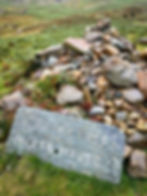
It was Day 4 of my thru-hike of The Cumbria Way, and I had to make it to Caldbeck, leaving The Lake District behind. Out of Keswick, ensuring I had plenty of snacks for the day, I passed Skiddaw and hit Glenderaterra Beck before reaching YHA Skiddaw House and then The River Caldew. One of the most complex parts of this thru-hike was navigating through the boggy and steep Grainsgill Beck towards High Pike, an old mining area. So, look out for the historical signs and sights. This bit of the thru-hike was tricky; there was no clear path, and sometimes, it was so steep you had to be careful with your footing. At the top of this gully, you head towards Lingy Hut, a tiny little thing I've heard people camp in for the night. It's not far from here that you reach the summit of High Pike (658m), a reasonably modest peak but with lovely views back over The Lake District and north towards the Solway of Firth. Then there is a quick descent into Caldbeck, and I recommend the pub I stayed in, The Oddfellows Arms; they had gorgeous, reasonably priced rooms with great food in a lovely restaurant.

Day 5 The Cumbria Way - Home
It was the last day, time to head home. I couldn't believe how fast the previous five days had gone by. After a beautiful sleep, I got a lovely breakfast of scrambled eggs on toast and fresh coffee. Then, I started my last miles along the River Caldew. Honestly, this scenery was pretty average compared to what I was used to, and my legs and feet were done. I had already decided to finish in Dalston as I didn't want the last few miles of my thru-hike to trudge through retail parks and back streets. So, this last bit of my hike was on woodland and farmland public footpaths, and as I was up early, I seemed to be the cobweb sweeper, something I did not enjoy!
I had finished my first ever thru-hike, just under 70 miles with 3062m of ascent, and I was over the moon to have completed it. It took me five days in total. And the result? I accomplished everything I set out to do—exploring The Lake District on foot, all solo—but more importantly, I had loads of fun doing it.
I cannot end this story without relaying the tale of what happened at the pub at the end. I had planned to meet my mum at the pub in Dalston for a celebration lunch, as she was concerned about me having to get the train back with sore legs, so she offered to pick me up. We met in the Blue Bell pub in Dalston, where I ordered a roast lamb dinner. Unfortunately, I had only taken two sips of my wine before my mum's wriggling about had pushed the table, in turn causing my glass to fall over, taking the candle stick with it. The ensuing mixture of wine, wax and broken glass ran all over me and into my hiking boots on the floor. And once again, I was drenched, and the actual mystery at this point was how I did not catch on fire. Good 'ole Mum. 😂
Overview of The Cumbria Way
The Cumbria Way is a backpacking route in the beautiful mountainous Lake District. It is 73 miles long, traversing from one end of the district to the other, starting in Ulverston and ending in Carlisle (Or Dalston for me, so 68 miles). I spent five days exploring this route by foot with only my backpack for company. The scenery is breathtaking, and there are so many photo opportunities. So be sure to make some time for The Cumbria Way! There's no better way to explore the beautiful Lake District than on foot.

I learnt that backpack packing doesn't have to be daunting! Sometimes, the most difficult tasks are also the ones with the best rewards. I knew that youth hostels and bunk barns offer cheap and unique places to sleep that are not full of young people. I learnt how fulfilling it could be to experience and explore new places at your own pace without timetables or distractions, enjoying the moments as they come along. So, where to go next?
Please check the weather before heading out; I use The Mountain Weather Information Service (MWIS) and look on The Met Office. As I'm out on my own, I always leave a map of my route with loved ones at home, and I check in throughout the day. I also use a Garmin Mini so they can contact and track me if I don't have a phone signal. I also always carry a paper map and compass and use GPS apps on my phone.
Please subscribe to my monthly newsletter here to receive more hiking routes, gear reviews, and other content straight to your inbox.
If you have any questions or comments on anything you have read, please get in touch with me here
If you don't already use the Ordnance Survey App, you can download it here, enabling you to download GPX routes. I use this App to plan all my hikes, and as its OS, it mirrors the paper map you should always use in conjunction.
Disclaimer: At the time of this walk, all the rights of way were open, and the terrain was easy to navigate; I followed all rights of way as per the OS maps, but things can change. Please be aware that the weather/farmers, etc., can change things, and therefore, the route may not be as possible as it was for me. Please make your checks beforehand. Please get in touch with me if any information that I have included has now changed.