
Great Gable Hike from Seathwaite
Updated: 4 days ago

Great Gable Hike Overview
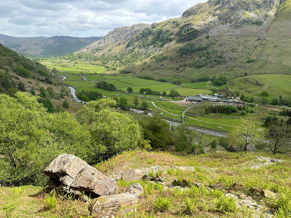
Location: Seathwaite, Borrowdale, Lake District, Cumbria
Route type: Circular
Distance: 9.3 km (5.8 miles)
Time: 4 hours on my OS Maps route
Ascent: 869 m
Difficulty: Difficult
Summits: Bae Brown, Green Gable and Great Gable
Terrain: Steep, rocky and rough, with scree sections and exposed ground around Windy Gap
Start and finish: Seathwaite
The Great Gable hike from Seathwaite is a difficult but brilliant Lake District walk. It includes a steep climb to Base Brown and Green Gable, a crossing of Windy Gap and the ascent of Great Gable, followed by a descent towards Styhead Tarn and Styhead Gill.
It’s a challenging route, with steep scree paths and sections that require careful navigation. Windy Gap is renowned for being windy and can be tricky to navigate. When I walked it, though, it wasn’t windy, which made the crossing much easier. I’d highly recommend this hike to experienced walkers who are comfortable with steep, rough mountain terrain.
Affiliate disclosure: This post may contain affiliate links. If you buy or subscribe through one of them, I may receive a small commission at no extra cost to you. I only share products and services I use or genuinely recommend.
Parking and Facilities at Seathwaite
Seathwaite Farm Campsite allows day parking and overnight parking, even if you’re not camping there. In quieter periods, I think you usually pay through an honesty box at the gate. During busy peak times, someone in a high-vis vest may be managing the parking, which gives you an idea of how popular this starting point can get. Follow the instructions on the day.
Public National Trust toilets are by the farm. I have to be honest: when I visited, they were pretty disgusting. If you’re staying at Seathwaite Farm Campsite, the campsite has newer Eco toilets for campers.
The campsite itself is back to basics, but it’s a great place to stay if you want to start the walk from Seathwaite. There are no shops or cafés on the route, so bring enough food and water for the walk.
Navigation and GPX
I planned this circular route using OS Maps. The route is 9.27 km, with 869 m of ascent. OS Maps estimates the time at 4 hours.
Open my Great Gable Hike route on OS Maps: https://explore.osmaps.com/route/34171209/great-gable-hike?lat=54.48742&lon=-3.21358&zoom=14.417&overlays=os-obstacles-layer&style=TopoAuto&type=2d
or download the GPX from above.
Download the route before you leave, but take a paper map and compass as a backup.
Great Gable Route Description
Climb from Seathwaite to Base Brown and Green Gable
From Seathwaite, follow the route beside Sour Milk Gill and then climb towards Base Brown and Green Gable. The path rises steadily, with steeper and rougher ground as you gain height. Take it at your own pace; this is a demanding climb, and there’s no need to rush it.
Cross Windy Gap to Great Gable
From Green Gable, continue across Windy Gap and climb to Great Gable. Windy Gap is exposed and windy, and rocky ground can make it hard to follow the route in poor visibility.
It wasn’t windy when I crossed, which made a big difference. Even in calm conditions, watch your footing and keep checking your position. The climb to Great Gable is steep and rocky, with scree in places.
Descend towards Styhead Tarn
After Great Gable, follow the route down towards Styhead Tarn. The descent is steep and rough in places, so take your time, especially where the ground is loose. It can feel harder once your legs are tired.
Follow Styhead Gill to Stockley Bridge
From Styhead Tarn, descend beside Styhead Gill towards Stockley Bridge. The route follows the gill downhill to the bridge, then returns through Seathwaite to the start.
How Difficult is the Great Gable Hike?
I’d rate this route as difficult. The distance is 9.42 km, but the 832 m of ascent, steep ground, rocky paths and scree make it a demanding mountain walk. Windy Gap adds another challenge because it can be exposed and tricky to navigate.
I’d recommend it to walkers with experience on rough, steep terrain who are confident navigating in the hills. It wouldn’t be my choice for a first mountain walk or on a day with poor weather.
My OS Maps route gives a time of 4 hours 1 minute. Treat that as a route estimate rather than a target, and allow extra time for breaks, photographs and the conditions underfoot.

Walking Great Gable Solo
This is a fantastic walk, but it deserves proper preparation if you’re heading out alone. Weather on the summits and around Windy Gap can differ greatly from conditions at Seathwaite.
Before you set off:
Check the mountain forecast, including wind speed and visibility.
Carry a paper map and compass, and know how to use them.
Download your route for offline use, but don’t rely on your phone as your only navigation tool.
Tell someone where you’re going and when you expect to be back.
Take waterproofs, warm layers, food, water, a charged phone and emergency equipment.
Be prepared to change your plan or turn back if the weather or terrain feels beyond your experience.

My Experience of the Great Gable Hike
I thought this was a great hike and would highly recommend it if you’re looking for a difficult Lake District route. The climbs are steep, the paths are rough in places, and there’s scree underfoot, so it feels like a proper mountain day.
I was particularly mindful of Windy Gap because it’s renowned for being windy and can be tricky to navigate. It wasn’t windy when I walked it, which made the crossing much easier. I’d still plan for stronger winds and take my time through that section.
Starting from Seathwaite worked well for me. The campsite is a great back-to-basics place to stay, and it’s useful to know you can park there even if you’re not camping.
Keep Exploring
Looking for another walk? Browse my hiking routes here.
For more solo hiking advice, you might also like:

Use code SHESGOINGSOLO30 for 30% off AllTrails
Great Gable and Green Gable FAQs
How long is the Great Gable and Green Gable hike from Seathwaite?
My OS Maps route is 9.42 km, with 832 m of ascent and 853 m of descent. The estimated time is 4 hours 1 minute, but allow extra time for breaks and conditions.
Is the Great Gable hike difficult?
Yes. This route is difficult, with steep climbs, rocky paths, and scree. Windy Gap can also be exposed and challenging to navigate.
Does this route include Green Gable?
Yes. The route climbs Green Gable first, crosses Windy Gap and then continues to Great Gable.
Is Windy Gap difficult to cross?
It can be. Windy Gap is exposed, known for being windy, and can be tricky to navigate. It wasn’t windy when I crossed, but check the mountain forecast and take a map and compass.

Can I park at Seathwaite if I’m not staying at the campsite?
Yes. Seathwaite Farm Campsite allows day and overnight parking even if you’re not camping there. Payment arrangements may vary depending on how busy it is, so follow the instructions at the gate or from the parking attendant.
Are there toilets at Seathwaite?
Public National Trust toilets are by the farm. When I visited, they were in a poor state. Seathwaite Farm Campsite has newer Eco toilets for campers.
What map do I need for Great Gable?
OS Explorer OL4 covers the area. Take a paper map and compass even if you’ve downloaded the OS Maps route.
When is the best time to walk Great Gable?
Choose a day with a suitable mountain forecast and good visibility, particularly if you’re unfamiliar with the route. Strong winds, low cloud, rain, snow, or ice can make the exposed, rocky sections more challenging.
Thanks for reading. If you’ve walked this route, I’d love to hear what you thought. Leave a comment below, or share any tips that might help another walker.
For more solo hiking, camping and outdoor adventures, sign up for my newsletter here. You can also explore my other hiking routes for ideas for your next day out.



Comments